Typhoon Podul pummels Taiwan, heads towards mainland / Photo: STR - CNA/AFP
Typhoon Podul pounded Taiwan on Wednesday, shutting down businesses, grounding flights and knocking out power for tens of thousands of households, while parts of mainland China made ready for the storm.
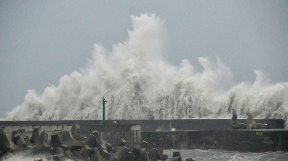
Wind gusts of up to 178 kilometres (111 miles) per hour were recorded shortly before the typhoon made landfall in Taitung County in southeastern Taiwan, the Central Weather Administration (CWA) said.
One person was missing after he went fishing and was swept away, and 33 have been injured, the National Fire Agency said.
More than 7,300 people have been evacuated from their homes, with trees and signs toppled as the storm swept across central and southern regions still recovering from storms last month.
"We are worried about this typhoon," Kaohsiung fisherman Huang Wei said as he tied down his boat with extra ropes hours ahead of Podul making landfall.
"We had already made general typhoon preparations yesterday, but this morning I woke up and saw news reports that the typhoon has intensified to be as strong as the last, (Typhoon) Krathon," Huang told AFP.
Krathon slammed into Kaohsiung in October, with wind gusts of 162 kph.
CWA Administrator Lu Kuo-chen told a briefing, attended by President Lai Ching-te, that Kaohsiung, Tainan and Chiayi in the southwest would become "major rainfall hotspots tonight".
- Flights grounded, schools shut -
All domestic flights across the island of 23 million people were cancelled on Wednesday, along with dozens of international journeys.
More than 134,500 households suffered power outages.
High-speed rail services on the west coast have been reduced, while train services in the southeast have been cancelled.
Many ferry services have also been suspended, with businesses and schools across the south closed.
More than 31,500 soldiers were ready to assist in rescue and relief efforts, disaster officials said.
The CWA expects mountainous areas in Kaohsiung and Tainan could be hit with a cumulative 400-600 millimetres (16-24 inches) of rain from Tuesday to Thursday.
Podul was expected to make landfall in mainland China along the southeastern coast between the cities of Xiamen and Shantou some time on Wednesday night or Thursday morning, Chinese state broadcaster CCTV said.
Some schools in Guangdong province have paused classes, while train and ferry services have been suspended, it said.
Parts of other provinces in central China, such as Hunan and Jiangxi, will also see heavy to torrential rain, CCTV said.
- Intense weather -
Typhoon Danas killed two people and injured hundreds when it dumped more than 500 mm of rain in early July.
That was followed by torrential rain from July 28 to August 4, with some areas recording more than Taiwan's rainfall of 2.1 metres for 2024.
The week of bad weather left five people dead, three missing, and 78 injured, a disaster official has said.
Taiwan is accustomed to frequent tropical storms from July to October.
Natural disasters are also common across mainland China, particularly in the summer, when some regions experience heavy rain while others bake in searing heat.
Flash floods and mudslides in northwest China last week killed 13 people, state media said, while heavy rain in Beijing in the north also killed 44 people last month.
Scientists have shown that human-driven climate change is causing more intense weather patterns that can make destructive floods more likely.
Global warming, driven largely by the burning of fossil fuels, is not just about rising temperatures, but also the knock-on effect of all the extra heat in the atmosphere and seas.
Warmer air can hold more water vapour, and warmer oceans mean greater evaporation, resulting in more intense downpours and storms.
G.Papazoglou--AN-GR